 |
|||
|
|
|||
|
Page Title:
Constructing a Map for the Range. |
|
||
| ||||||||||
|
|
 TM 9-6920-361-13&P
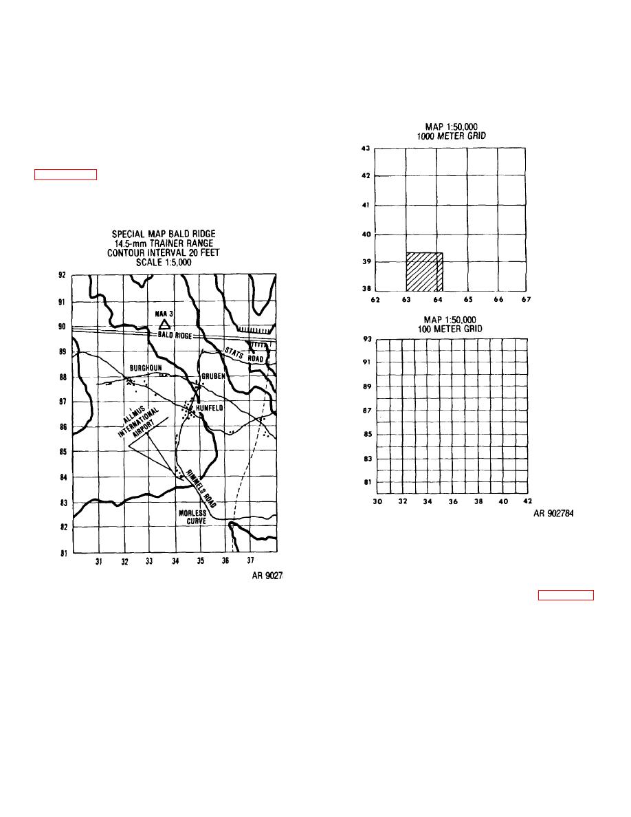
(3) The grid lines on the special map are
2-3. Constructing a Map for the Range.
scaled to 100 meters (1,000 decimeters) apart so the
observer can use the normal observed fire (OF) fan and
a. Maps
for
Permanent
and
Semipermanent
the coordinate scale that he would use with a1:50,000
Ranges.
map.
(1) For permanent
and
semipermanent
ranges a 1:5,000 scale map of the impact area should be
constructed. Most training aids centers can enlarge a
portion of a map in order to create the required scale.
meters by 1,100 meters section of a range at Fort Sill,
Okla. The map shows the contour lines and terrain
features shown on the original map.
Figure 2-13. Labeling the special map
(4) When labeling the grid lines on the special
map use the 100 meter value. For example, if you are
preparing a map of the area which is located in the
shaded square of a 1:50,000 map, you would label the
Figure 2-12. Example of a 14.5-mm range map
grid lines of the special map as shown in figure 2-13,
leaving off the 10,000 meter digit and adding the 100
(2) After the roads, buildings, and other
meter digit.
constructed terrain features (such as small mounds or
b. Maps for a Temporary) Range.
orchards) have been positioned and accurately located
(1) Since a temporary range may be available
by survey, they are included on the map. The map need
to a unit for only one or two days, it is not practical to
not be in color if the terrain is fairly level and there are
construct an elaborate range map. Therefore, the unit
few contour lines. However, there should be sufficient
may begin the service practice by constructing an
information on buildings, roads, orchards, etc., to permit
observed fire (OF) chart and then convert to a surveyed
the observer to locate targets in relation to a known point
firing chart when survey is completed.
that he can identify on the ground and on the map.
2-10
|
|
Privacy Statement - Press Release - Copyright Information. - Contact Us |